
A one-day gain, measured retrospectively
Google DeepMind says WeatherNext Cyclones predicts storm track, intensity and wind structure in one system. In its evaluation of cyclones from 2023 and 2024, the model gained more than 24 hours of average lead time across those measures: its three-day forecasts were comparable with what leading earlier systems achieved at two days.
That is a substantial reported result, but it is not a guarantee for every basin, storm or rapid-intensification event. The central figures come from the team that built the model and should be treated as a benchmark claim until reproduced under comparable conditions.
One model, many possible futures
DeepMind says the system was trained end to end on nearly 20 terabytes of atmospheric data and the IBTrACS archive of almost 5,000 historical storms. A 15-day forecast can run in under a minute on a TPU, and Google's 2026 system generates 1,000 ensemble members to represent multiple possible outcomes.
The full cyclone model uses inputs at roughly 28-kilometre spacing, while a smaller version uses roughly 111 kilometres. DeepMind itself calls the continued cyclone skill at those resolutions an open research question. Ensemble size describes sampled possibilities; it does not remove uncertainty.
Open weights do not make the full model lightweight
Google has released code and checkpoints in its official repository. The code is under Apache 2.0 and the repository states that other material is under CC BY 4.0, while input datasets can carry separate terms.
The repository also describes the software as experimental and warns that the full configuration needs accelerator-class hardware such as an H100 GPU or TPU. A compact notebook is more accessible, but it is not equivalent to reproducing the full released configuration.
Forecast support is not warning authority
DeepMind says WeatherNext helped the US National Hurricane Center during Hurricane Melissa. The NHC's own verification report documents unusually accurate forecasts for the storm, but it does not isolate a causal share for Google's model. LUMACTA NEWS therefore reports the collaboration without crediting one system for the final public warning.
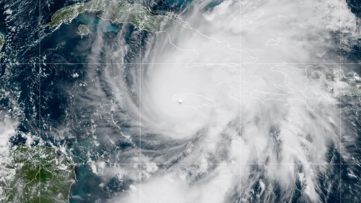
The hero image is NOAA's real GOES-19 observation of Melissa, not an AI output. WeatherNext remains a decision-support system; official warnings and evacuation guidance must come from the relevant meteorological and emergency authorities.
Twenty possible tracks are not twenty promises
Imagine a deliberately simplified, fictional ensemble with 20 modelled storm tracks. Five cross a marked coastal area, while 15 do not. Five divided by 20 is 25% of those scenarios; it is not, by itself, a verified 25% probability that the area will be hit. The members share a forecasting system and are not independent eyewitnesses to the future.
To interpret the fraction as a useful probability, forecasters need evidence of calibration: across many comparable forecasts given similar probabilities, how often did the defined event actually happen? They also need an unambiguous event. A storm centre crossing a boundary is different from damaging winds reaching a town, because winds extend beyond the centre.
| What is being compared | Reference visible in DeepMind’s historical figures | What a fair follow-up needs |
|---|---|---|
| Track / position error | ECMWF-ENS track forecasts. | Same forecast lead time, storms and geographic coverage. |
| Intensity error | HWRF intensity forecasts. | Same intensity definition and verification observations. |
| Probabilistic usefulness | A distribution of outcomes, not just one average track. | Calibration and rare-event performance, not a single successful landfall example. |
These are the references in the creator’s published figures, not a new Lumacta ranking of all forecasting systems. An average gain in the 2023–2024 evaluation cannot promise another 24 hours for every future storm. Comparing one model’s best case against another model’s average would also be misleading.
A practical newsroom should keep the issue time, forecast lead time and warning authority visible together. If an update changes the distribution, that is new information, not necessarily proof the earlier forecast was careless. None of the numbers in our fictional 20-track example describes current weather: follow the relevant national meteorological and emergency services for warnings and protective action.
Sources & Methods
Published reporting and original source context are retained. September 23 revision: Added an ensemble-reading example and explained the distinct track and intensity baselines shown by DeepMind. No live warning or independent forecast test is presented. New explanatory examples are explicitly hypothetical; no independent hardware or model benchmark is claimed.
- Google DeepMind — WeatherNext Cyclones — primary research announcement
- Google DeepMind — WeatherNext repository — primary code and model source
- National Hurricane Center — 2025 Hurricane Season Forecast Verification Report — primary agency report on NHC forecast performance
- NOAA — GOES floater archive for Hurricane Melissa — image source
- NOAA Ocean Service — image-use guidance — image rights source